#1 by
Linus
, Sat Mar 12, 2016 12:36 pm
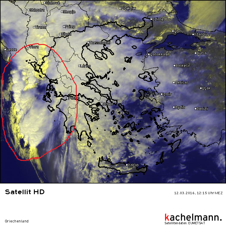
The line of thunderstorms that has formed off the western coast of Greece is now starting to gradually make landfall. Currently the extreme northwest of Greece is affected. The main risks to be expected are large amounts of rain and storm gusts. There is also a slightly increased risk of tornados and water spouts.
Linus Höller - President of M.I.L.K. weather
Linus
Posts: 2.140
Points: 1.549
Date registered 04.09.2012
Jump to:
| | - Rewards for each individual person
REPORT SEVERE WEATHER!
| | - Report Severe Weather
| | - Live tickers!
| | - What the symbols mean
| | - We moved
| | - You felt an earthquake? tell us!
| | - Intense earthquake review
Chasing reports/ Severe weather rep...
| | - Chasing reports / Severe weather re...
| | - Analysis
| | - Warnings
| | - Recent changes
Forecasts
| | - Severe weather forecasts
| | - Forecasts
More Weather
| | - What did I capture here?
| | - "Normal" Weather
| | - Weather for you
| | - Military operations and bases
| | - Wind Storms
Please enter a reason for warning.
Reason below posting.
Spam Netiquette Moderator rights Form
other
This post contains unwanted advertisements.
This post violates the forum rules regarding netiquette
You used your moderator rights in a way harming MILK stormchasers
Beiträge, die IN GROßBUCHSTABEN oder fett geschrieben sind bitte vermeiden.
{[userwarning_empty_error]}
The reason mentioned above will be used. Click here , to adjust the content of the private message.
Define the content of the pm-notification here.
Current warnings
© M.I.L.K. 2017
M.I.L.K. - Meteorology: Information. Learning. Knowledge.


