Blog Categories
Most popular blog posts
Like this Blog
Latest blog posts
Latest blog comments
Most active Bloggers
Categories
|
|
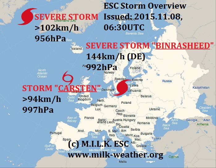
by Linus
08.11.2015 07:44
|
|

|
|
by Linus
02.11.2015 05:47
|
|
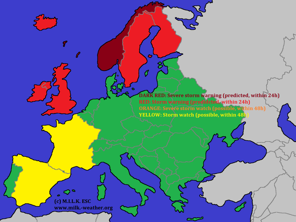
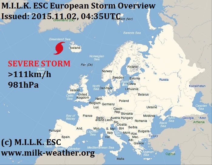
There is currently a severe storm that will affect wide parts of northern Europe today, and is now located near Iceland. Warnings have been issued. There is also a low pressure area, named YORSCH II, over the Iberian peninsula. It is possible that this system will turn into a storm within the next 24 hours, but it is not totally sure. Therefore storm watches have been issued for both Spain and France. See below for more information.
|
|
by Linus
01.11.2015 07:48
|
|
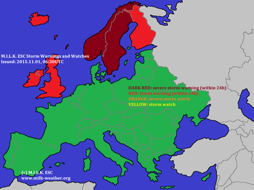
There are currently two storms in the MILK ESC warning area. One of them is currently located to the south of Greenland. MILK ESC calculated gusts of over 116km/h in this storm. It will move towards the east and affect everything from Iceland to the British Isles within 24h. The second, by far stronger, storm is located in the far N of Norway. Severe storm warnings have been issued for Norway and Sweden. See below for more information!

|
|
by Linus
25.10.2015 06:30
|
|
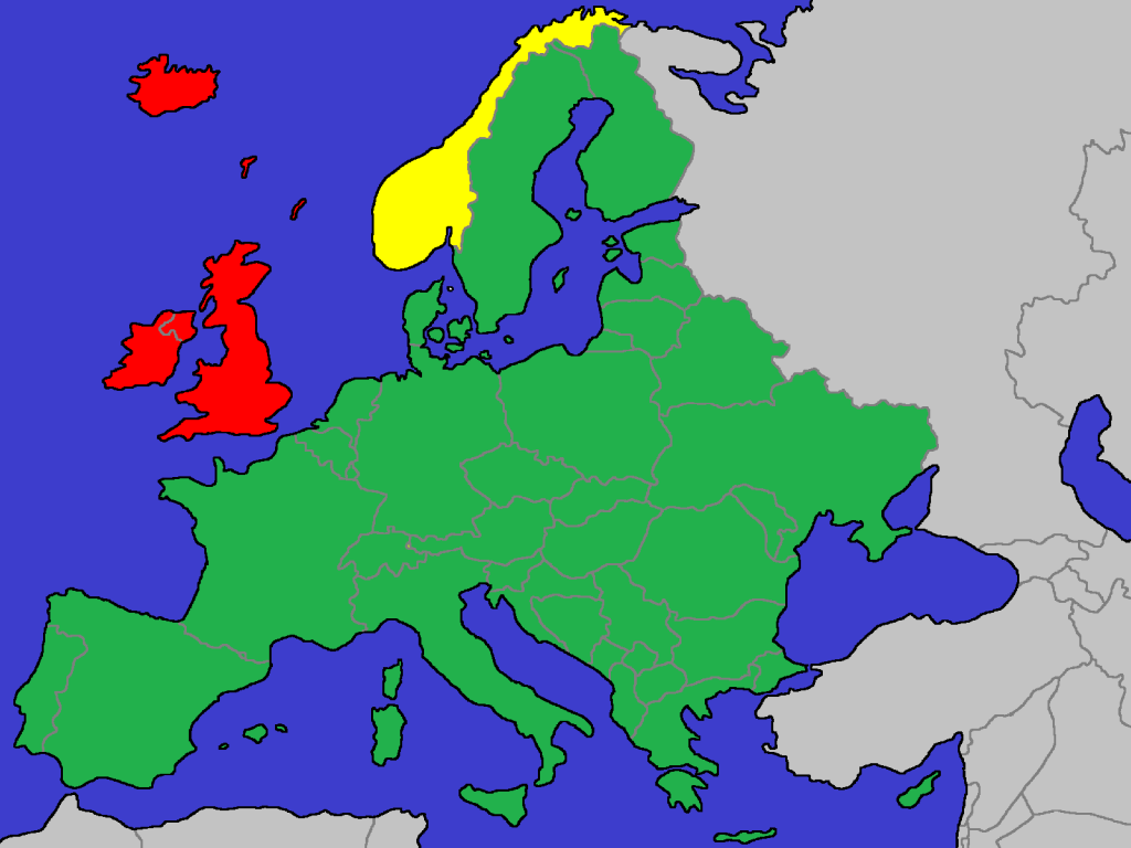
The severe storm WYMAR is predicted to make landfall in the British Isles within 24 hours. Peak gusts in the storm currently are calculated to be near 150km/h, the central pressure currently is 979hPa. Below are the warnings that were issued. Red: Storm warning (within 24h) Yellow: Storm watch (within 48h).
|
|
by Linus
24.10.2015 07:36
|
|
We currently have a storm low pressure system in the far N of Europe, currently affecting mainly Iceland and the coast of Norway. However, out on the open Atlantic a new, currently still weak, low pressure area has showed up - this is predicted to turn into a severe storm within 24h. We will keep you updated.

|
|
by Linus
05.10.2015 05:51
|
|
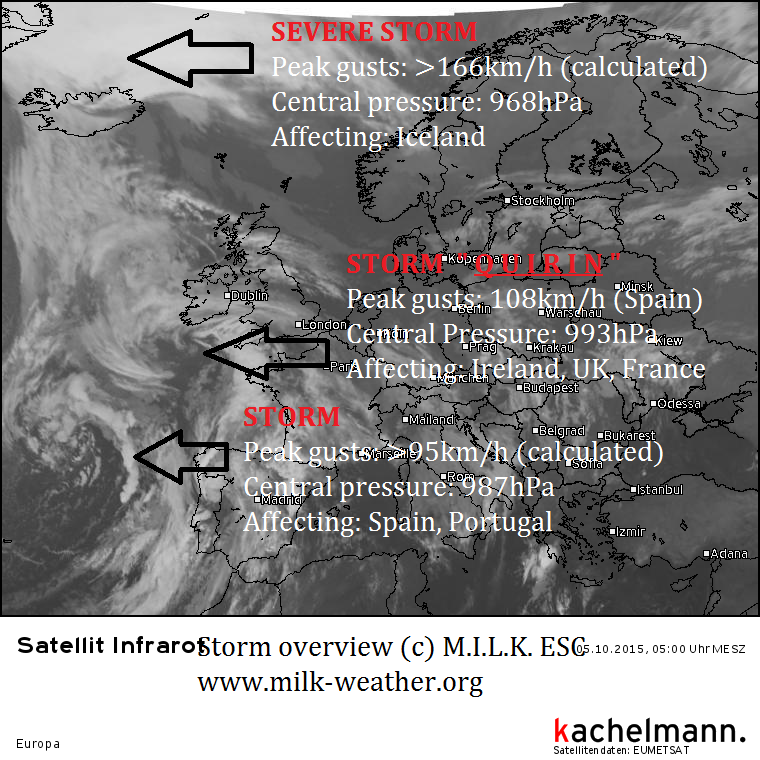
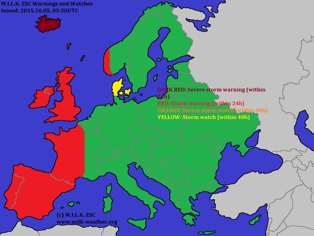
We currently have three storms affecting W Europe. The storm in Iceland is by far the strongest – with peak gusts up to 166km/h (the value calculated by MILK ESC) and a central pressure of 968hPa this is a strong storm fairly early in the season. The storm that affected Spain and Portugal, as well as France yesterday now has a name: QUIRIN. Other than that, a third, new storm has formed in the Atlantic to the W of France. This storm is going to again bring wind to Portugal, Spain and France. Warnings have been issued.

|
|
by Linus
04.10.2015 06:44
|
|
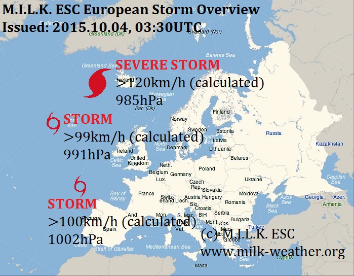
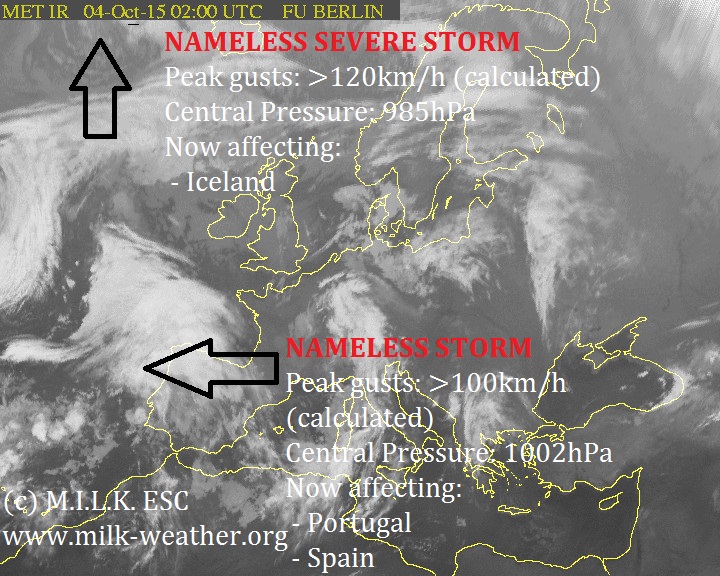
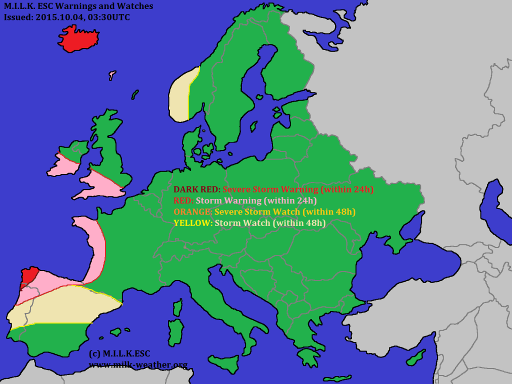
MILK ESC is currently tracking three storms in the region. One of the storms is currently making landfall on the Iberian peninsula with gusts up to 100km/h (calculated). A second storm is lingering in the middle of the north atlantic with peak gusts near 100km/h, but it is not forecast to make landfall within 48h. The third storm is classified as a severe storm and is currently located to the SW of Iceland, but a severe storm warning has been issued for Iceland – action will start here within 24 hours. Below is the ESC Overview.
|
|
by Linus
22.09.2015 06:46
|
|
We have a storm E of Greenland currently, but other than that, we have no storm systems in thhe European region currently. We will keep you updated.

|
|
by Linus
19.09.2015 10:01
|
|
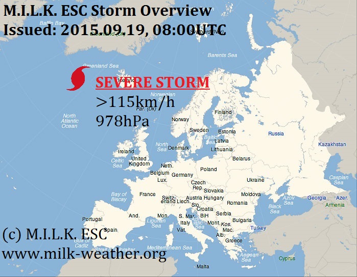
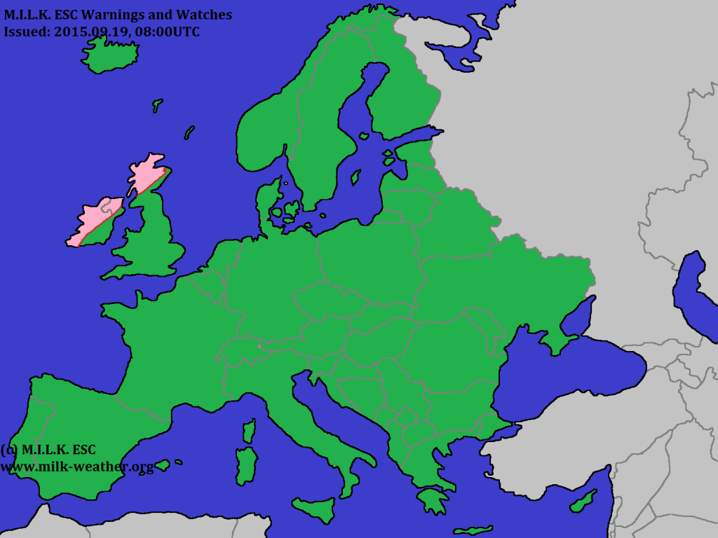
We currently have a severe storm, that is still unnamed, to the west of Iceland. Here is the current ESC overview!

|
|
by Linus
07.09.2015 05:57
|
|
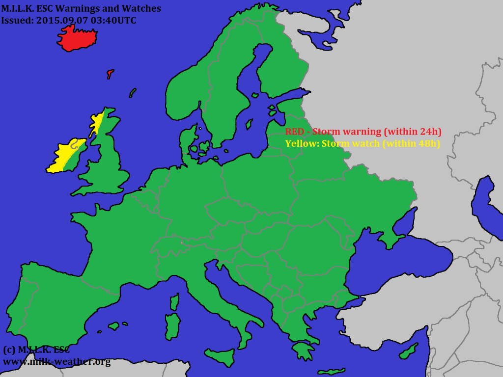
After storm JONAS has dissipated, only one storm in the N Atlantic remains. The MILK ESC overview.


|
|
by Linus
06.09.2015 09:28
|
|
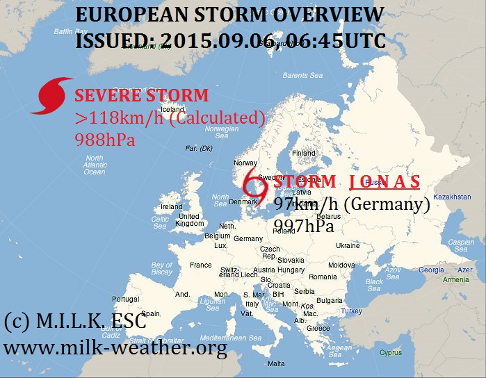
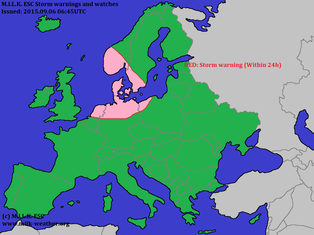
We currently have two storm systems in the European region. While JONAS continues to affect nations around the Baltic, the nameless storm over the N Atlantic has intensified – and is forecast to further intensify.

|
|
by Linus
30.08.2015 11:00
|
|
Achtung/ Gewitter heute vor allem in NW DE. Informationen werden folgen.
|
|
by Linus
08.08.2015 07:13
|
|
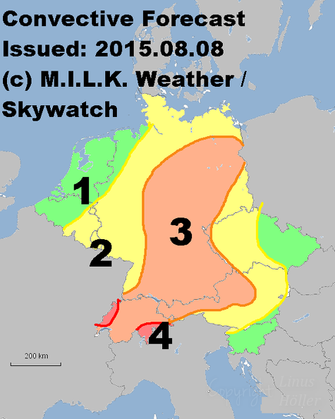
4: Severe thunderstorms likely / Unwetter warhscheinlich
3: Severe thunderstorms possible / Unwetter möglich
2: Thunderstorms likely / Gewitter wahrscheinlich
1: Thunderstorms possible / Gewitter möglich
|
|
by Linus
03.08.2015 08:07
|
|
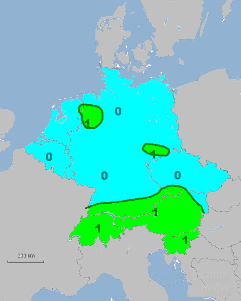
0: Gewitter Unwahrscheinlich / Thunderstorms Unlikely
1: Gewitter Möglich / Thunderstorms Possible
|
|
